Difference between revisions of "RS hikes"
Jump to navigation
Jump to search
| Line 7: | Line 7: | ||
** Avalanche Campground, August 11- 13, 2011 | ** Avalanche Campground, August 11- 13, 2011 | ||
*** Piegan Pass Trailhead, August 12, 2011 | *** Piegan Pass Trailhead, August 12, 2011 | ||
| − | *** Sperry Challet | + | *** Sperry Challet, August 12, 2011 |
** Many Glacier, August 14, 2011 | ** Many Glacier, August 14, 2011 | ||
| − | *** | + | *** Swiftcurrent Lake, Lake Josephine, Grinnel Lake |
* Table Mountain (Wyoming), October 1, 2011 [http://en.wikipedia.org/wiki/Table_Mountain_%28Wyoming%29] [http://www.free-press.biz/Teton-Valley/Table-Mountain-Trail.html] | * Table Mountain (Wyoming), October 1, 2011 [http://en.wikipedia.org/wiki/Table_Mountain_%28Wyoming%29] [http://www.free-press.biz/Teton-Valley/Table-Mountain-Trail.html] | ||
Revision as of 16:42, 11 October 2011
- Borah Peak (Idaho), 2010 [1]
- Glacier National Park (Montana), August 11- 14, 2011 [2]
- Avalanche Campground, August 11- 13, 2011
- Piegan Pass Trailhead, August 12, 2011
- Sperry Challet, August 12, 2011
- Many Glacier, August 14, 2011
- Swiftcurrent Lake, Lake Josephine, Grinnel Lake
- Avalanche Campground, August 11- 13, 2011
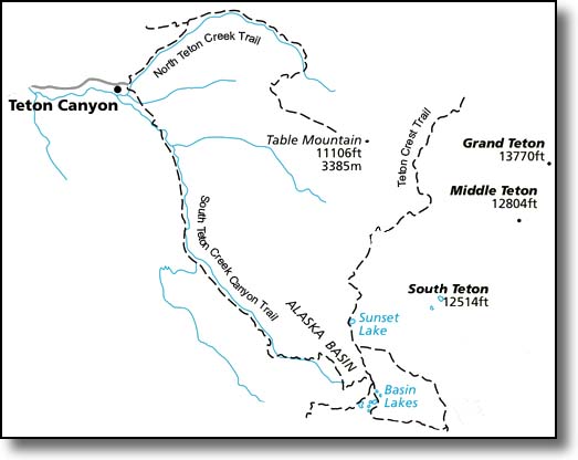
 Table Mountain offers some of the best views in the Tetons - it was the location of the first photograph ever taken of
 the Grand Teton in 1872. Once at the top, the west faces of the Grand and Middle Tetons and Mount Owen tower overhead.
 The trail is about 12 miles round-trip with over 4,000 feet elevation gain and quite steep in place.
- Redfish lake (Idaho), October 6 - 8, 2011 [5]
